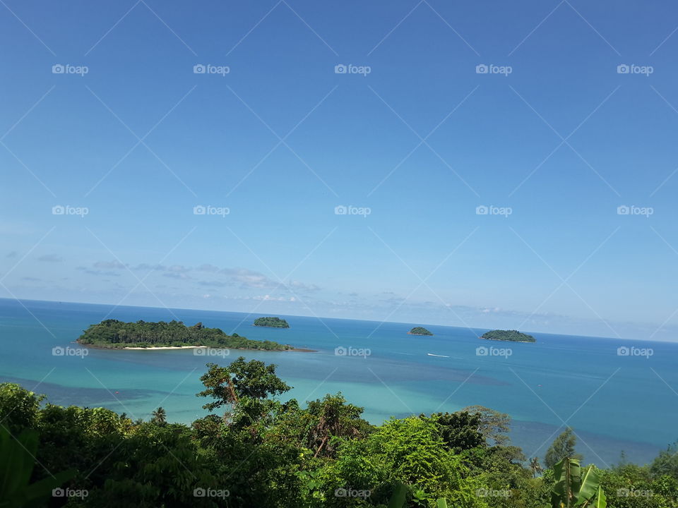
Koh Chang is the largest island in the Gulf of Thailand. And second largest in Thailand after Phuket Island. The area of ​​about 429 square kilometers or more than 2.6 hundred rai, located about 8 kilometers from Laem Ngob, formerly part of Laem Ngop District. But is now a district of Trat. There are government offices, police stations, hospitals and the location of the national park.

Topography of Koh Chang Most are high mountains. There is a cliff complex. The highest peak is Salak Phet, 743 meters above sea level. The forest is abundant. The source of many waterfalls and streams. That nourishes people and life on the island. And some areas are rubber plantations and orchards.

In addition, Koh Chang has many beautiful natural beaches lined along the west coast, such as White Sand Beach, Klong Prao Beach, Kai Bae Beach, and a number of small islands are surrounded by a number of islands such as Koh Lam Koa Ngam Koh Ngam. Koh Wai, Koh Kra, Koh Rang, Koh Man Nok Island, Koh Mak, Koh Mak, Koh Mak, Koh Kham etc.

Koh Chang is the largest island in the Gulf of Thailand. And second largest in Thailand after Phuket Island. The area of ​​about 429 square kilometers or more than 2.6 hundred rai, located about 8 kilometers from Laem Ngob, formerly part of Laem Ngop District. But is now a district of Trat. There are government offices, police stations, hospitals and the location of the national park. Topography of Koh Chang Most are high mountains. There is a cliff complex. The highest peak is Salak Phet, 743 meters above sea level. The forest is abundant. The source of many waterfalls and streams. That nourishes people and life on the island. And some areas are rubber plantations and orchards. In addition, Koh Chang has many beautiful natural beaches lined along the west coast, such as White Sand Beach, Klong Prao Beach, Kai Bae Beach, and a number of small islands are surrounded by a number of islands such as Koh Lam Koa Ngam Koh Ngam. Koh Wai, Koh Kra, Koh Rang, Koh Man Nok Island, Koh Mak, Koh Mak, Koh Mak, Koh Kham etc.

Photo by phatthrawadee.meekaew

Royalties free, Commercial & Editorial use

$10.00

Rating: 5  out of 5  based on 3 user ratings.

Stock photo: Koh Chang is the largest island in the Gulf of Thailand. And second largest in Thailand after Phuket Island. The area of ​​about 429 square kilometers or more than 2.6 hundred rai, located about 8 kilometers from Laem Ngob, formerly part of Laem Ngop District. But is now a district of Trat. There are government offices, police stations, hospitals and the location of the national park. Topography of Koh Chang Most are high mountains. There is a cliff complex. The highest peak is Salak Phet, 743 meters above sea level. The forest is abundant. The source of many waterfalls and streams. That nourishes people and life on the island. And some areas are rubber plantations and orchards. In addition, Koh Chang has many beautiful natural beaches lined along the west coast, such as White Sand Beach, Klong Prao Beach, Kai Bae Beach, and a number of small islands are surrounded by a number of islands such as Koh Lam Koa Ngam Koh Ngam. Koh Wai, Koh Kra, Koh Rang, Koh Man Nok Island, Koh Mak, Koh Mak, Koh Mak, Koh Kham etc. was taken by phatthrawadee.meekaew .